
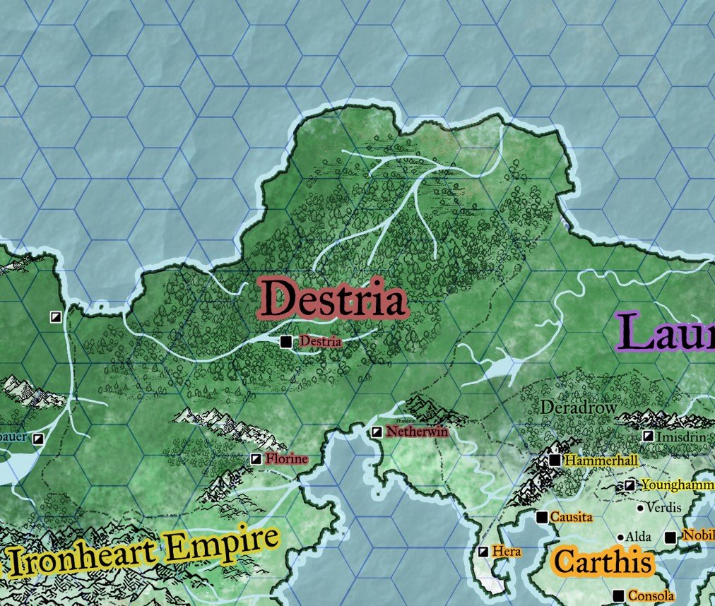
Map of Estria. Small hex = 54 miles, Large hex = 162 miles

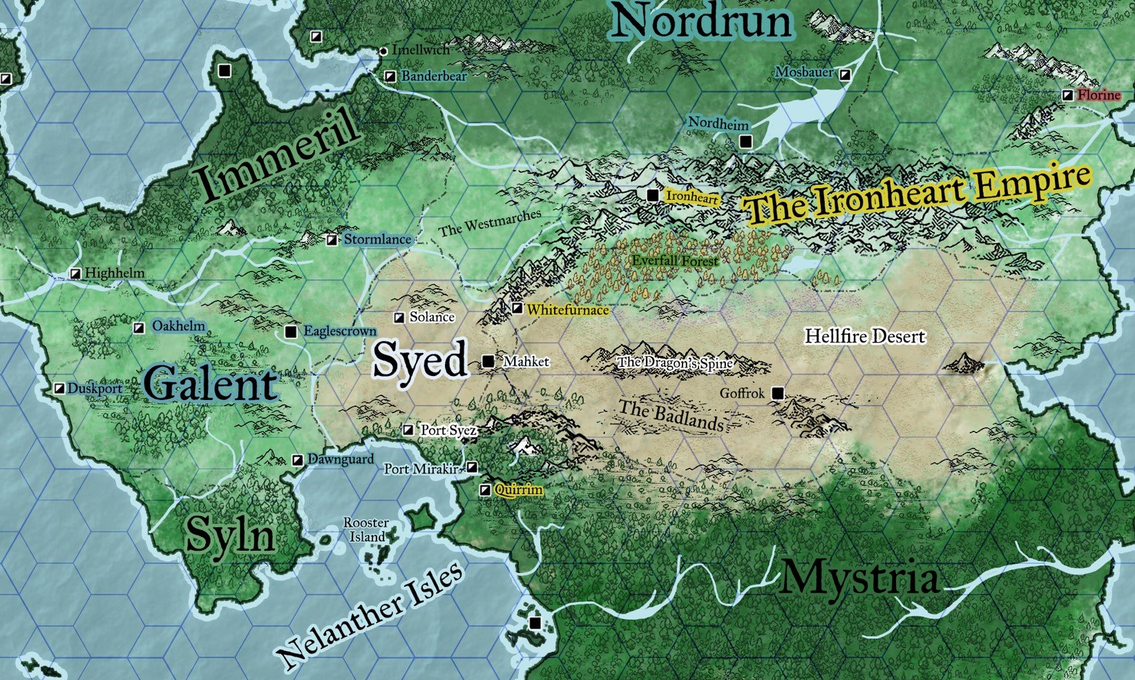

Estria is a campaign setting for fantasy tabletop RPGs. In this project I set out to create a fantasy world with a realistic climate and scale.
To achieve this goal, I defined landmasses and tectonics which in turn defines wind-directions and pressure levels for the continent. From there I could define regional climates and topographical features which allowed me to designate national areas from the geographical borders. Finally I populated these areas and added an accurate hex-scale based on smaller maps of areas previously designed.